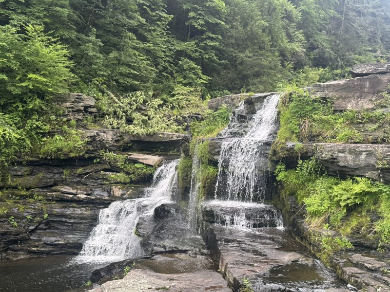
Glass at The Ledges
Our latest favourite. Deck views over the waterfall; pricey but excellent.
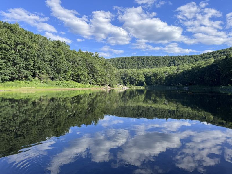
Our own notes on where to eat, what to see, where to hike and which waterfalls are worth the drive from Masthope, with the history behind each place.
There are no big supermarkets nearby, so you’ll eat out. These are the places we go back to, with the honest version of each.
Our latest favourite. Deck views over the waterfall; pricey but excellent.
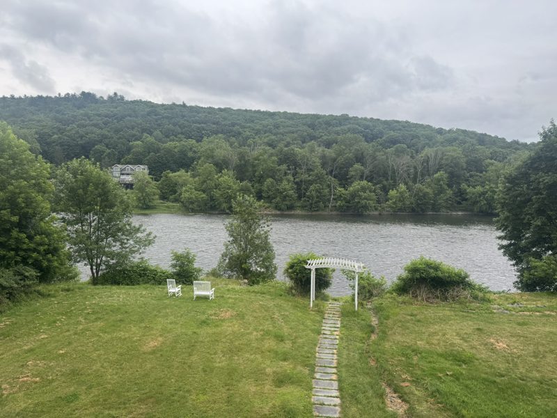
A deck over the Delaware and reasonable food. Book the deck for Saturdays and Sundays.
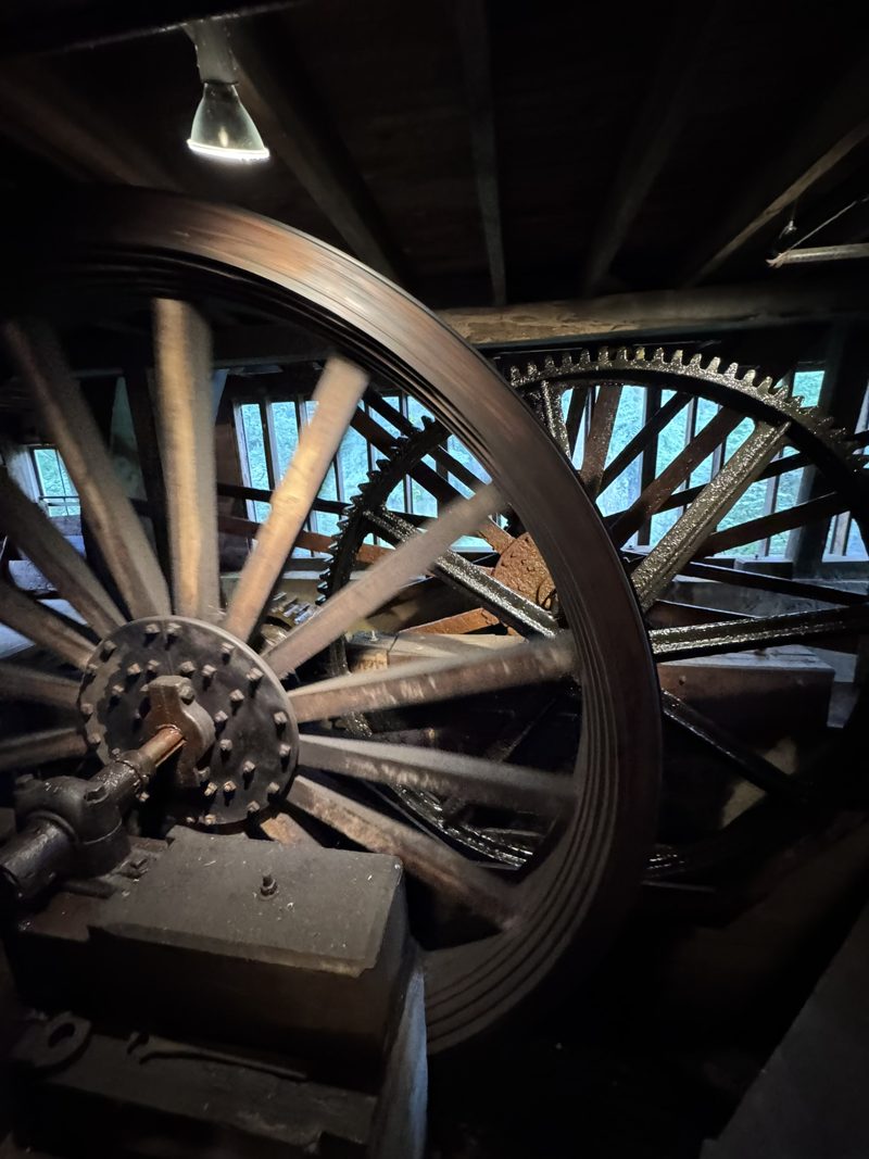
Simple, very tasty food with a surprise of Vietnamese dishes, plus a bakery with the best pies and cookies. Ask to see the mill: the gears are right behind the glass.
The café opened in 1989 inside the Upper Mill, an early-1800s gristmill on Sawkill Creek that still has its original grinding machinery and a three-story waterwheel. It was one of nine water-powered mills in Milford back then, six of them on this one creek. The mill is on the National Register of Historic Places, and you can take a free self-guided tour during opening hours.
Family-run Italian with excellent pizza and an Italian bakery, just across the river.
A small, simple spot with very tasty Eastern European specialties.
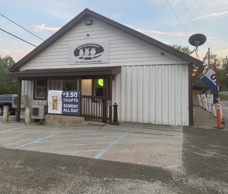
Big portions in a cosy setting. The drive alone is worth it for the wildlife.
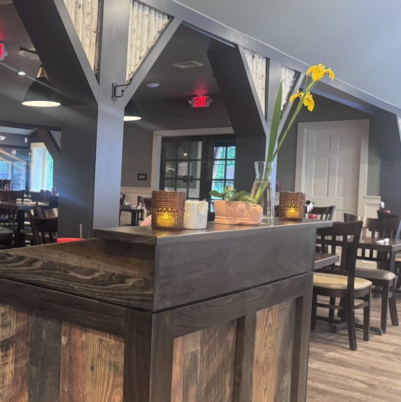
New and close by. Very decent food and friendly service.
The community’s own restaurant. Decent, and you can walk home.
Good coffee with a waterfall in view from the parking lot.
History, a winery, a railway you pedal yourself, and a river you can drift down with a toddler.
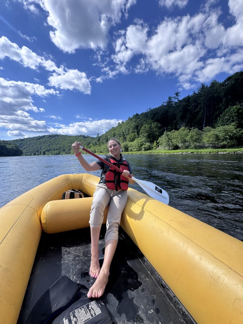
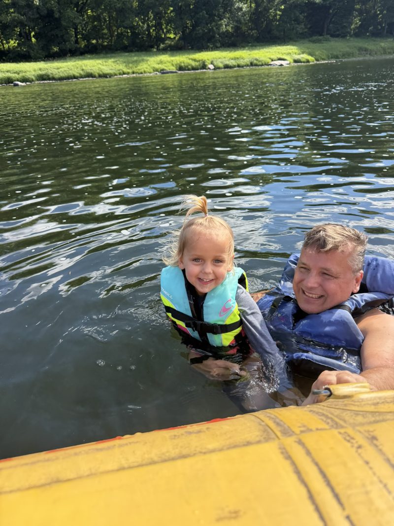
With Reber River Trips: dropped in Lackawaxen, then 2.5 gentle hours back to Barryville. We did it with a 3-year-old: in life jackets, a swim break beside the raft is the best part.
In 1978 Congress protected 73.4 miles of this river as the Upper Delaware Scenic and Recreational River. Long before tourist rafts, timber rafts ruled: from the 1760s, and at their peak over 50 million board feet of pine and hemlock floated downstream each year.
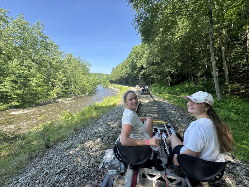
Pedal along the Lackawaxen River on the old railway, with electric assist if you tire. We saw bald eagles.
A family-run outfit with custom-built electric railbikes for two or four people. The ride is about 6 miles and takes roughly two hours, along the same tracks the Stourbridge Line uses: 25 miles of the old Erie Lackawanna railroad from Honesdale down to Lackawaxen, hugging the river most of the way. Rides go rain or shine, closed-toe shoes are required, and booking ahead is highly recommended.
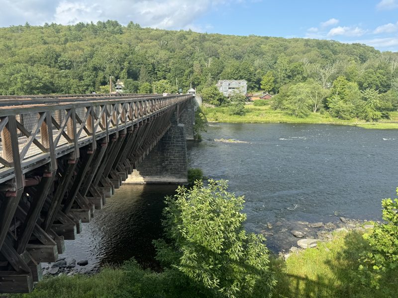
Walk across to the old toll house and the Towpath trail.
Begun in 1847 to carry the Delaware & Hudson Canal over the river, it was designed by John A. Roebling, later the engineer of the Brooklyn Bridge. It is the oldest existing wire suspension bridge in the US and a National Historic Landmark.
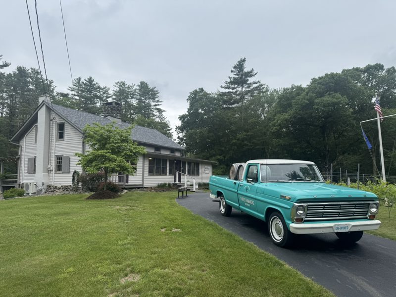
Live music on Saturday afternoons. Book the cheese and wine tasting 24 hours ahead. Take your glass for a stroll around the grounds.
The winery is named after three brothers, Israel, Abel and Eli Hammers, Philadelphia Quakers who built the white clapboard farmhouse in 1820, together with a dam and a sawmill. It’s the oldest known building in the township. Next to it stands an oak believed to be 250 to 300 years old. Today it’s a small family winery on a wooded 15-acre property with a pond and walking trails, with history signs along the way. In the cold months you can reserve a heated snow globe on the lawn.
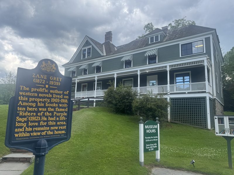
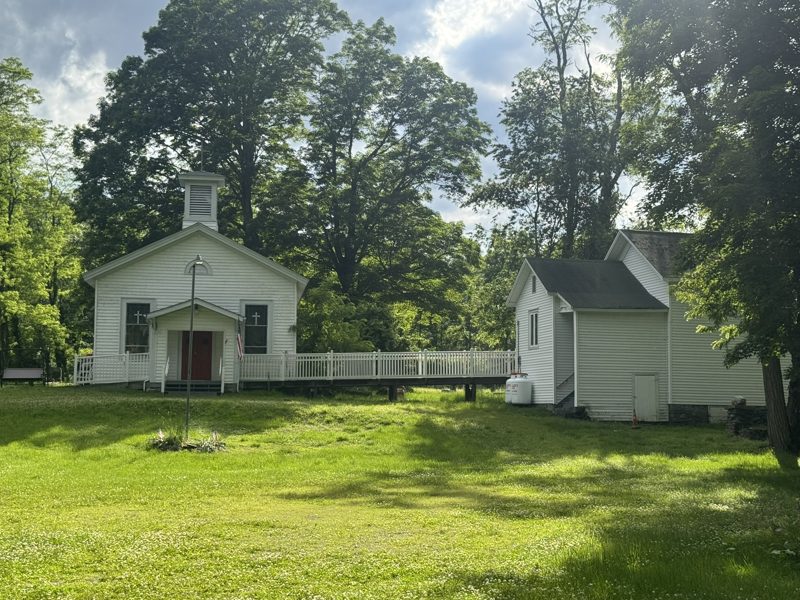
A sleepy stroll where the rivers meet: the museum, the old church, and deer on the riverbank.
Zane Grey, the “father of the Western novel”, lived here from 1905 to 1918. The National Park Service bought the house in 1989, and Grey and his wife Dolly are buried just down the road.
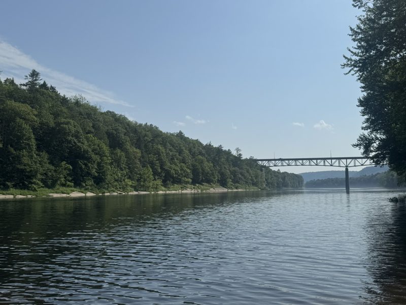
Our favourite river swim: a grassy beach on a calm stretch of the Delaware, with picnic tables in the shade and the bridge to New Jersey in the distance. Pair it with lunch in Milford.
Milford Beach sits at the northern tip of the Delaware Water Gap National Recreation Area. It’s a day-use fee area where you can swim or launch your own boat, and the northern end of the McDade Recreational Trail starts by the launches. Lifeguard days change from year to year, so check the NPS page before you go. No inflatables in the swim area, and life jackets are recommended.
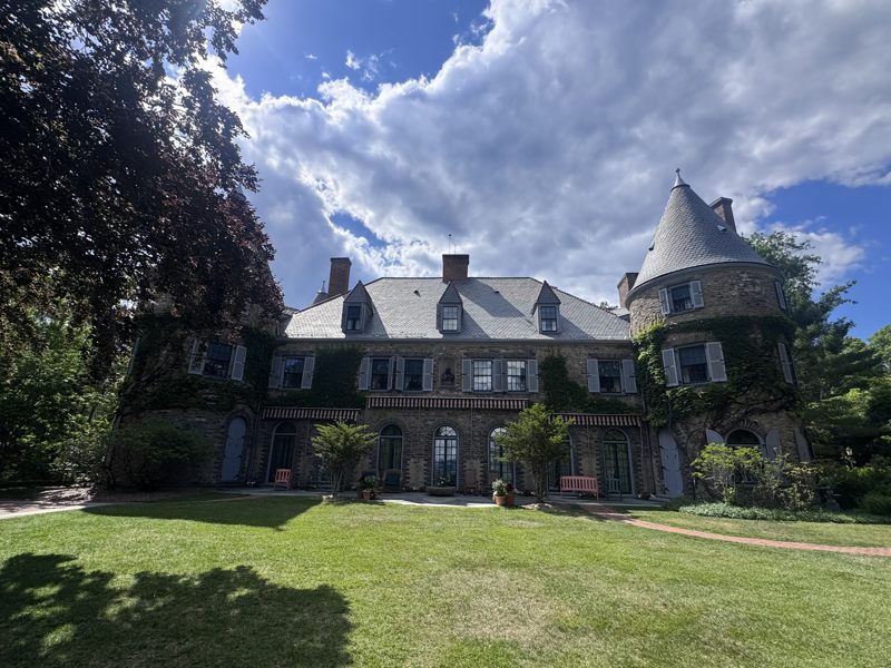
A charming town with cafés, and a French-château-style mansion with grounds worth exploring.
Grey Towers was completed in 1886 by James Pinchot and became the home of his son Gifford Pinchot, founder and first chief of the US Forest Service and twice governor of Pennsylvania. It was at Grey Towers that his father first encouraged him to consider forestry. In 1963 the family gave the house and 102 acres to the Forest Service, which now runs it as a National Historic Site with public programs and tours on conservation.
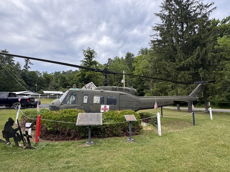
A quiet roadside stop: a real US Army “Huey” medevac helicopter, kept among small flags, with bronze plaques honouring those who served in Vietnam.
The Bell UH-1 “Huey” became the symbol of the Vietnam War, and in Vietnam it was used above all as a medical helicopter, flying wounded soldiers out of the field. That’s why this one carries the red cross. Take a moment to read the plaques before you drive on to Milford or Grey Towers.
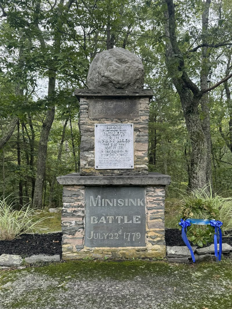
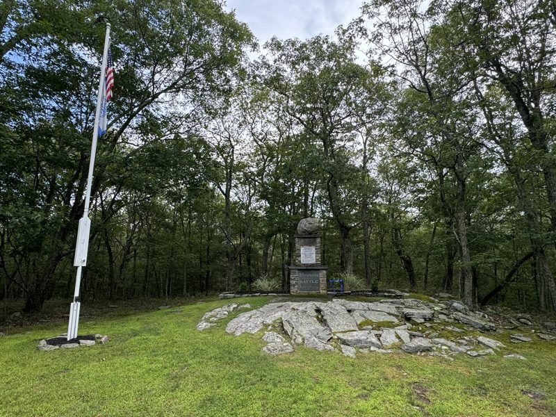
Peaceful, with short trails and a monument on the hilltop.
On July 22, 1779, local militia fought Joseph Brant’s Mohawk and Loyalist raiders here: the only Revolutionary War battle in the Upper Delaware valley. The park was first protected in the 1890s to save the hilltop from bluestone quarrying. The stone monument with the boulder on top was erected on the battle’s 100th anniversary, July 22, 1879, and still gets fresh wreaths today.
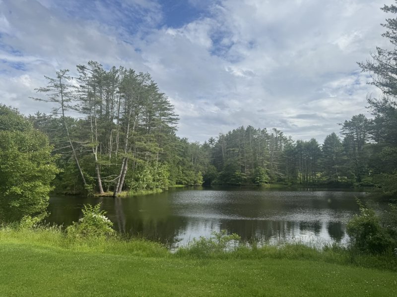
A glass museum, meadow trails and summer concerts. No dogs.
Christian Dorflinger’s White Mills glassworks (1865–1921) cut crystal for the White House, from the Lincoln administration through Wilson’s. The sanctuary sits on his family estate, with the glass museum in their home.
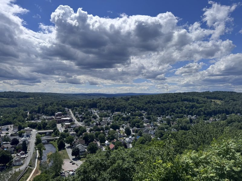
The best view of Honesdale: the whole town, the Lackawaxen River and the hills beyond, from a ledge 300 feet up. Pair it with the Old Stone Jail and a coffee at Black and Brass.
In 1841, Philip Hone, president of the D&H Canal Company and a former mayor of New York (Honesdale is named after him), came up the canal with his friend Washington Irving, author of “Rip Van Winkle” and “The Legend of Sleepy Hollow”. Irving was so taken with the cliff that he had to climb it, and Hone named it after him. A grand Irving Cliff Hotel was later built on the summit, but it never saw a guest. Today the overlook sits in Gibbons Memorial Park, with a fenced viewing area, benches and history signs, reached by a short but moderately steep trail or by car. At Christmas, a 50-foot star lights up the cliff. Leashed dogs are welcome.
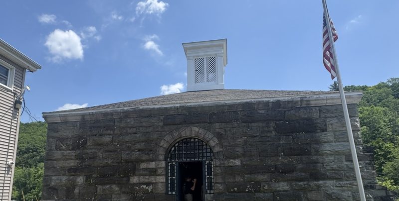
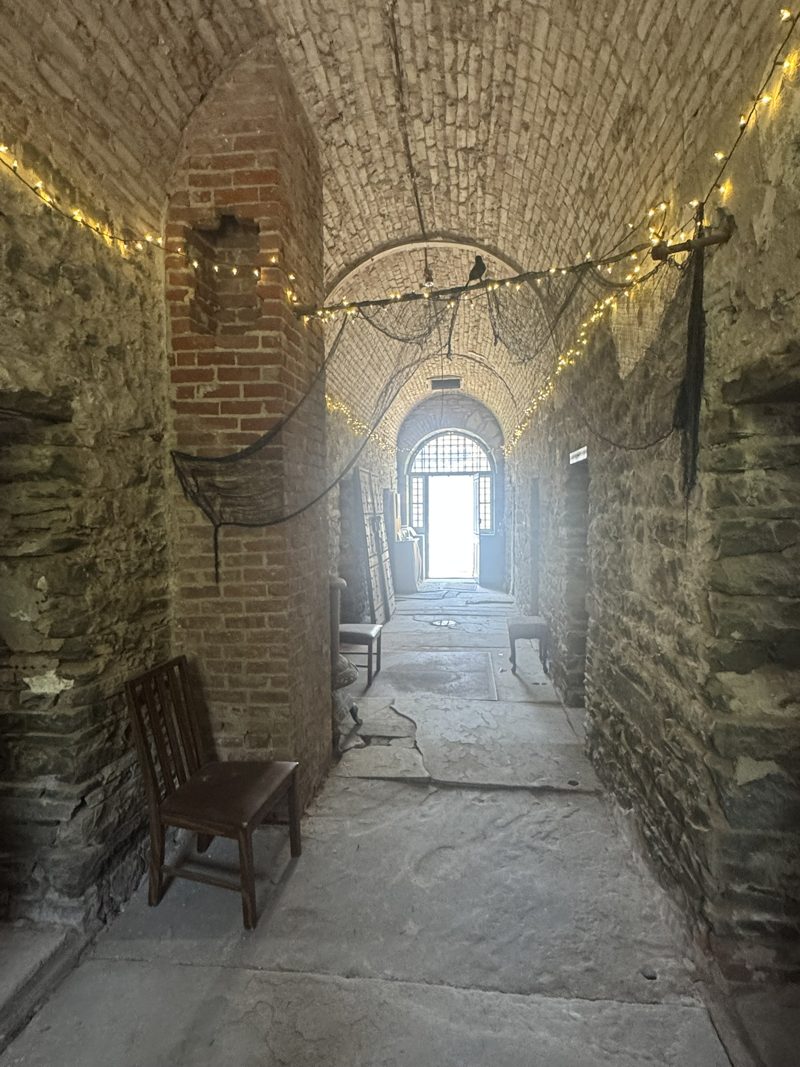
A squat stone jail by the Lackawaxen River, with barrel-vaulted brick corridors that feel like a castle dungeon. Spooky in the best way.
Built in 1859, it held Wayne County’s prisoners until 1935. It’s built almost entirely of rough stone, and the damp, gloomy cellblock has been compared to a dungeon. The Wayne County Historical Society runs free open days in the warmer months, and “Jail Tales” evenings around Halloween. Check their events page before you go, or call to book a private tour.
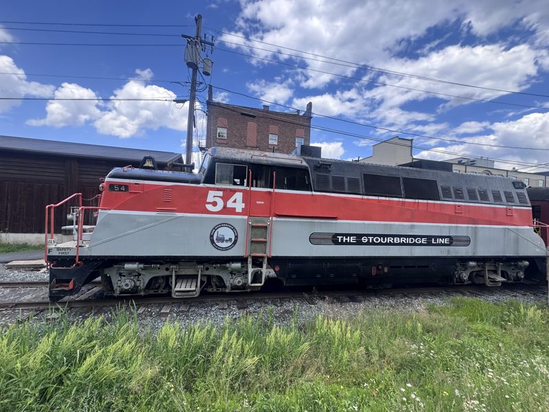
A scenic heritage train. We did the dinner train: fine, but a bit pricey for what it is.
Honesdale is where the Stourbridge Lion, shipped over from England, made its trial run on August 8, 1829: the first locomotive to run on rails in America, bought to move coal for the D&H Canal Company. Today’s excursions run seasonally along 25 miles of the old Erie Lackawanna line between Honesdale, Hawley and Lackawaxen, hugging the Lackawaxen River, the same tracks as the Rail Bike. Much of the route can’t be reached by car, and you may spot bald eagles circling overhead. A full-size replica of the Lion is on show at the Wayne County Historical Society museum in Honesdale.
From a pond loop that starts near the front door to a cliff-and-waterfall loop that will make you work for it.
Around the pond and into the forest, crossing shallow streams twice. Groundhogs by the bench at dusk.
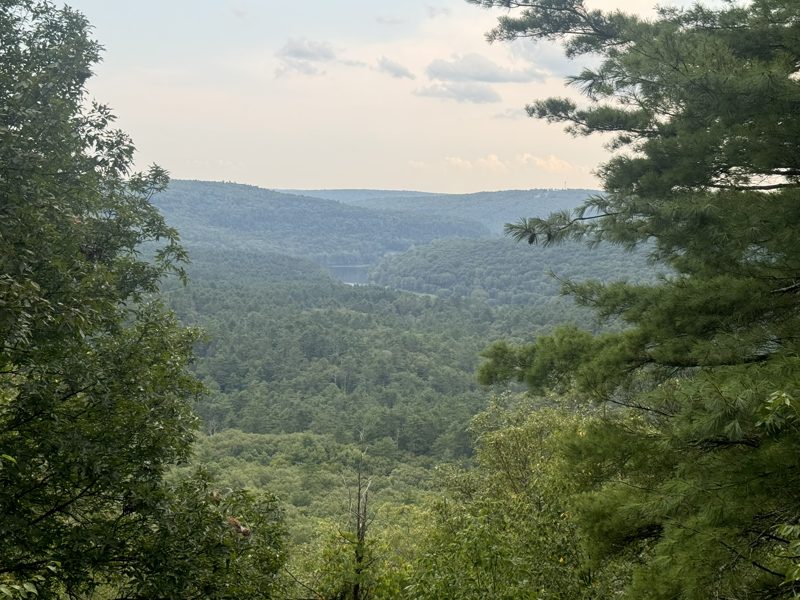
Old stone quarries taken back by the forest, and a view at the top you earn.
The quarries are left over from the 19th-century bluestone trade. Stone was cut by hand and shipped down the D&H Canal to the Hudson River.
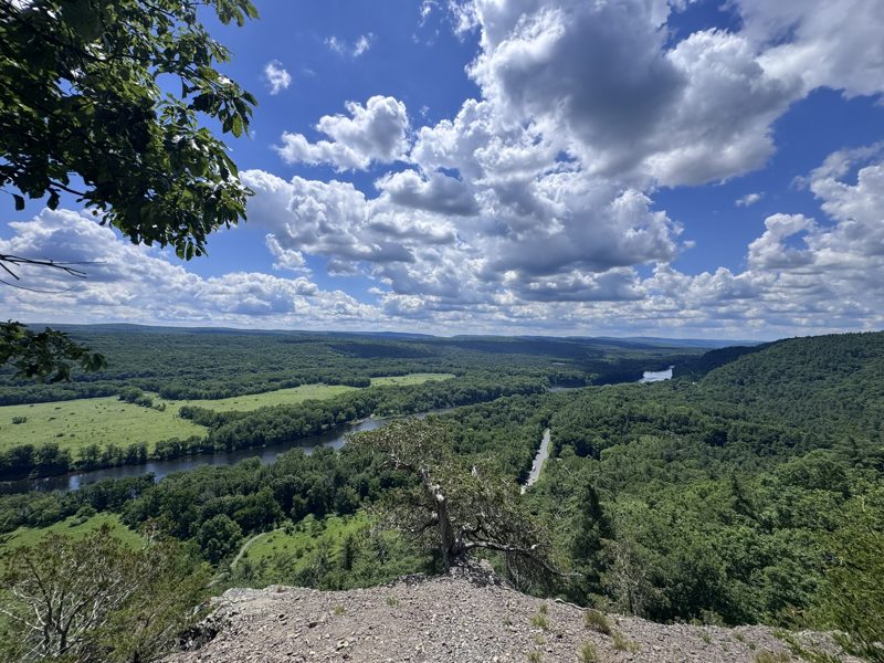
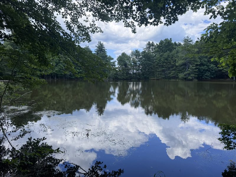
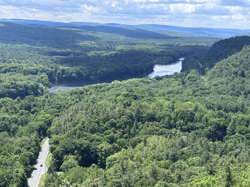
Cliffs, viewpoints, a pond and a waterfall in one epic loop near Milford.
The land belonged to the Buchanan family from 1803 until 2002, when it became part of the Delaware Water Gap National Recreation Area; the Buchanan Trail is named after them. The area takes its name from the Cliff Park golf course, the first in America designed by a woman, Annie R. Buchanan. The loop combines the Buchanan and Pond Loop trails, Hackers Falls and the Cliff Trail along Raymondskill Ridge, with views straight down to the Delaware and New Jersey. Look for prickly-pear cacti blooming in the ledges in spring. Note: no food, picnics or alcohol are allowed on the Cliff Park trails or at Hackers Falls.
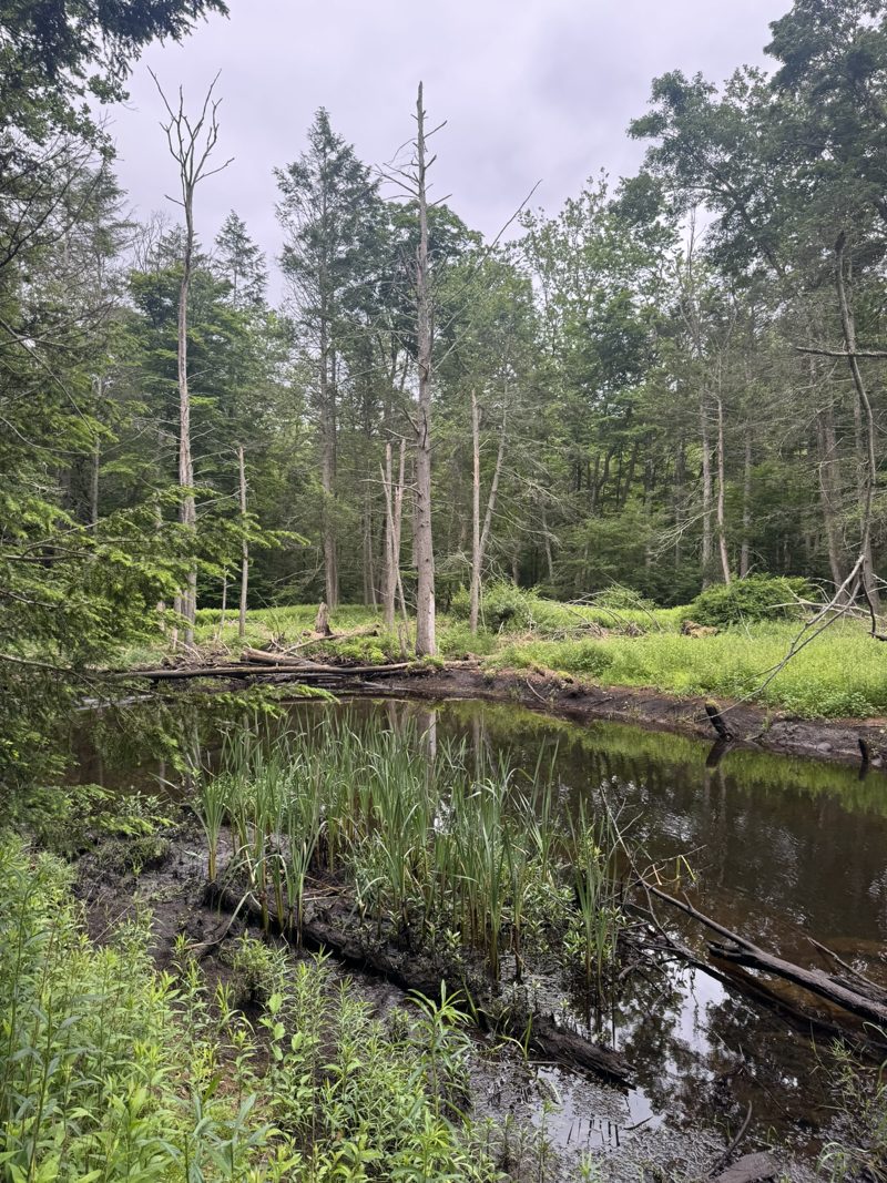
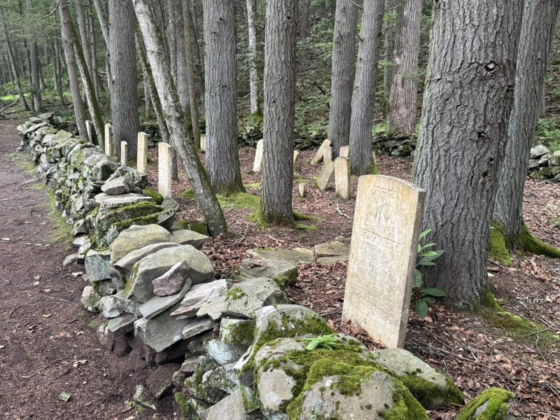
A beautiful river and forest, with an old settlers’ cemetery at the end. Quiet, shady and great for eagle spotting.
The trail follows the Mongaup River up from where it meets the Delaware, through hemlock forest and quiet backwaters, and ends at the Lower Mongaup or Knight Cemetery: a family plot of the Knights, early settlers, ringed by a dry-stone wall. The stones are weathered, but look closely and you’ll find dates from the early 1800s. The trail is part of the National Park Service’s “Take a Hike!” programme on the Upper Delaware. It closes every year from December through March to protect endangered wildlife, and dogs are welcome.
A forest path around a quiet lake in the State Game Lands, a short drive away.
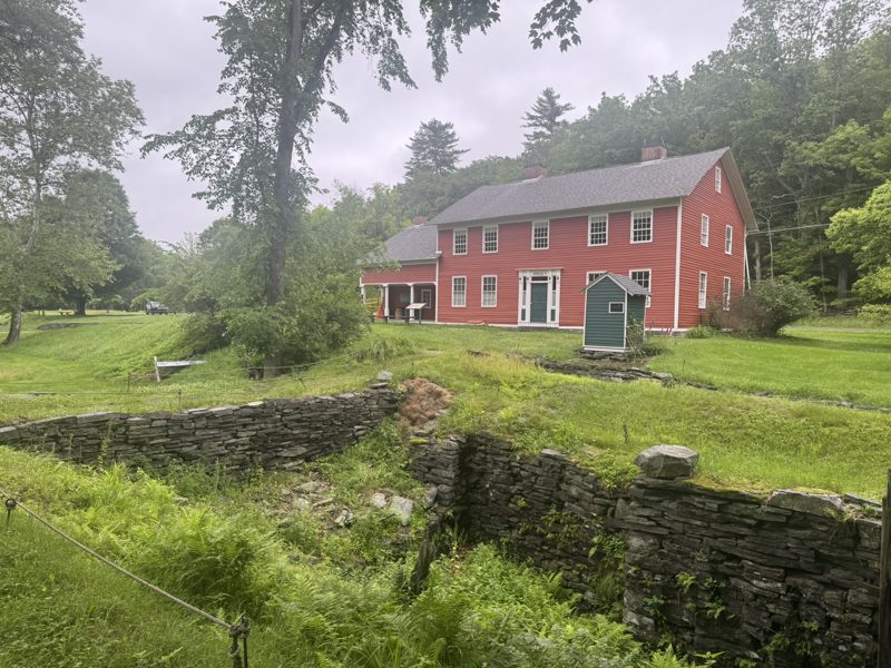
Along the old canal and a lock by a historic farmhouse. Something different.
The D&H Canal was dug in the late 1820s for one job: carrying anthracite coal from northeastern Pennsylvania to market in New York. Lock 31 was built in 1827 right behind the Daniels farmhouse, which made the farm far more valuable overnight. In 1878 a Brooklyn grocer, Ernst Hintze, bought it, turned it into a canal-front hotel with a liquor licence and sold groceries to the boatmen. Look for the door on the canal side that still reads “Hintze’s”. The Wayne County Historical Society bought the house in 2001 and owns a mile of the canal, with plans for a living history museum.
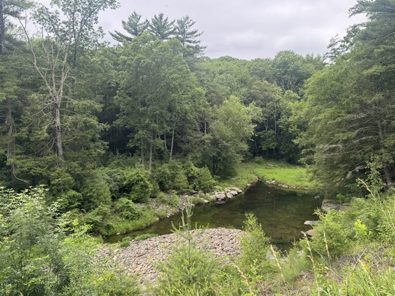
Two easy trails that join up: a shady forest walk down the old creek bed, and a lakeside stroll along the dike of Lake Wallenpaupack. Good for a relaxed morning.
The Creek Trail starts at the Wallenpaupack Environmental Learning Center, which has exhibits about the dam. It follows the path the Wallenpaupack Creek took before the huge flowline to the hydroelectric plant was built between 1924 and 1926. A wooden bridge over that flowline gives the best view of the dam, built nearly a century ago with steam and mule power. The trail ends at a staircase and deck overlooking the wetlands. The lake it created covers more than 5,700 acres. The Creek Trail is 1.2 miles out and back, on gravel and mulch, and closes in winter. The Lake Trail adds 3 miles out and back along the shore.
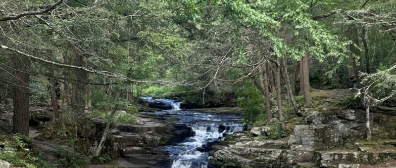
A short, easy creekside walk to a pretty cascade, perfect with little legs and the dog. Leashed dogs are welcome here, unlike at Raymondskill or Childs Park.
The trail starts across the road from the Lower Lake dam and follows the East Branch of the Wallenpaupack Creek, which drains the park’s two lakes, past rock shelves and hemlocks. The state park named it for the many small waterfalls on this stretch of the creek. A footbridge lets you cross and come back along the other bank. Promised Land State Park has about 50 miles of trails with the surrounding Delaware State Forest, plus lakes for swimming, boating and fishing.
Forest and wildflower meadows. Private sanctuary, free entry, no dogs.
A rare chance to walk right along the Delaware, across Roebling’s bridge.
Through forest and meadow to the best view from the top of the falls. Slippery near the river.
The famous one, the free “mini” version, the tallest in Pennsylvania, and one you can see from a coffee shop.
The easiest waterfall on our list: no trail, no boots. Order a glass of wine on the decks at Glass in the Ledges Hotel and the falls are right in front of you.
The bluestone building beside the falls was built in 1890 by John S. O’Connor as a cut-glass factory. He had spent 23 years running the Dorflinger glassworks in White Mills before going out on his own, and the creek turned a big water wheel in the basement to power his plant. Glass restaurant sits in that old basement today. In the 1920s the creek was dammed to create Lake Wallenpaupack for a hydroelectric plant, which is why the flow varies. The factory is now on the National Register of Historic Places, next door to the old Hawley Silk Mill.
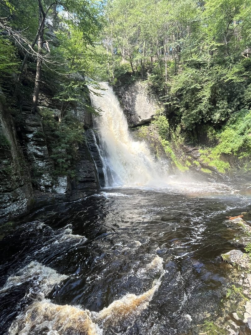
Eight falls. Take the red trail to see them all; you’ll need some fitness for the climbs.
Charles E. Peters opened the falls to visitors in 1904 and billed them as the “Niagara of Pennsylvania”. He started with a single path and a swinging bridge over the head of the main falls, which drops about 100 feet. Today eight falls are spread over some 300 acres, linked by boardwalks, stairs and bridges. A nod to us Dutch: “kill” comes from the Dutch word for creek.
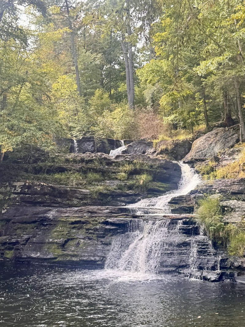
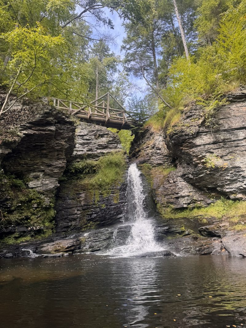
Our “mini Bushkill”: three lovely falls, no entrance fee and no crowds.
Philadelphia newspaperman and philanthropist George W. Childs bought this land along Dingmans Creek in 1892. After he died, his widow Emma donated it to Pennsylvania in 1912, and it became part of the Delaware Water Gap National Recreation Area in 1983. The 1.4-mile loop follows the creek through a cool hemlock ravine past Factory, Fulmer and Deer Leap Falls. At Factory Falls you’ll see the stone ruins of Joseph Brooks’s woolen mill, which closed when he died in 1832, plus shelters built by the Civilian Conservation Corps. No dogs, no food, and no swimming or wading anywhere in the creek.
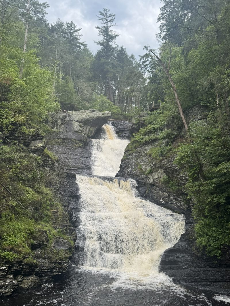
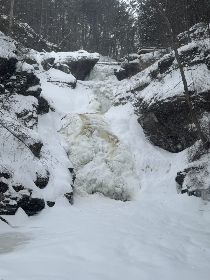
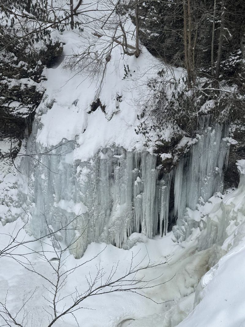
Pennsylvania’s tallest falls. Combine it with lunch in Milford.
Three tiers stacked together: according to the National Park Service, their combined height is only a few feet shorter than Niagara Falls. The trail is only about 0.3 mile, but steep and uneven, with 178 feet of elevation change. No dogs, no food or picnics, and no swimming or wading in or above the falls. Park in the lower or upper lot on Raymondskill Road; the upper lot, with the restrooms, closes from early January to mid-April. Hackers Falls and the Cliff Park trails start just across the road. Come back in winter too: the falls freeze into curtains of ice. The steep steps can be slippery then, so wear boots with good grip.
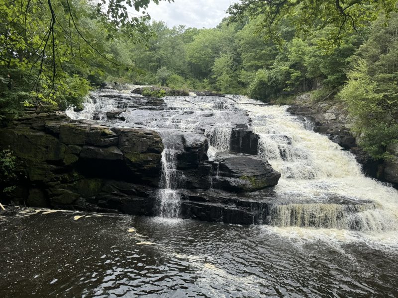
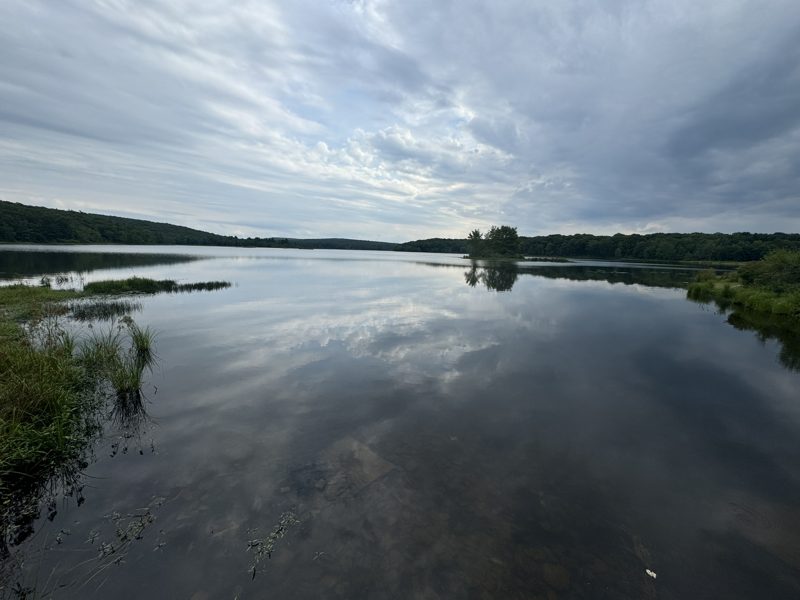
Easy access to the bottom from the east side; the best view from the top on the west side. Walk up to the lake above the falls too: it’s wide, quiet and full of birds.
The falls are on Route 6, about 10 miles northwest of Milford, just below the dam of Shohola Lake. The Pennsylvania Game Commission created the long, shallow lake in 1967 for waterfowl. It later played a key part in bringing bald eagles back to Pennsylvania, and eagles nest there today, so bring binoculars. The falls are in State Game Land 180, which is open to hunters in season, so wear something orange in the fall.
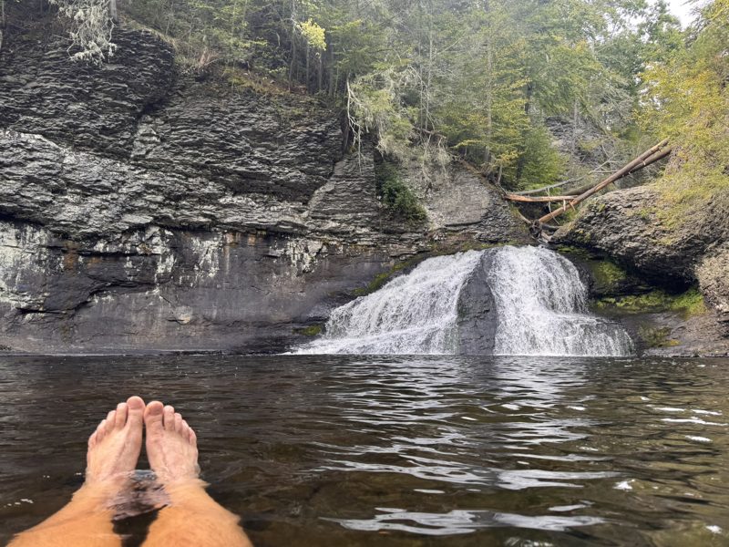
The reward at the end of our favourite challenging loop. On a warm day, nothing beats cooling your feet in the pool below the falls.
A short but dramatic fan-shaped drop in the Cliff Park part of the Delaware Water Gap National Recreation Area. You can reach it on its own via the Hackers Trail, about 1.4 miles out and back, starting across the road from the Raymondskill Falls lower parking lot. Stay out of the water upstream of the falls, and leave the picnic at home: food and alcohol aren’t allowed on the Cliff Park trails.
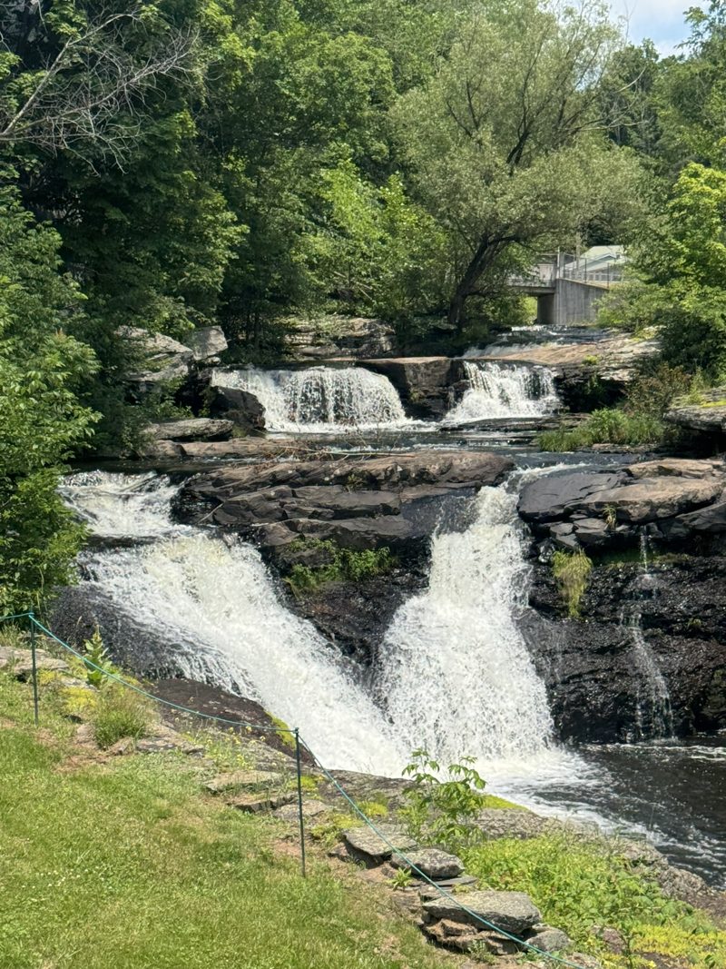
Right behind Black and Brass Coffee. Order a latte and walk over: you can see the falls from the café parking lot.
Carley Brook tumbles down in three drops, about 15 to 20 feet in total, with a fourth small drop just downstream, before joining the Lackawaxen River along Route 6. The Lackawaxen (Lenape for “swift waters”) is the river that carried the D&H Canal from Honesdale all the way down to our village, where it meets the Delaware.
Sources & further reading: National Park Service (Roebling's Aqueduct, Zane Grey, Upper Delaware history, Raymondskill Falls) · Minisink Battleground Park · Grey Towers NHS · Dorflinger Glass Museum · Stourbridge Lion marker · Historic Hotels of America: Ledges Hotel · National Trust for Historic Preservation
Send your dates. We reply within 24 hours, at 6% below Airbnb with no service fee.
Request your datesWe'll float back four times a year with open dates at the subscriber price, trail news and who's been in the garden.
Four emails a year. Unsubscribe any time.
Eagle alerts, snowstorms, trail finds and the deer report. The Upper Delaware, live from the cottage.
Follow on Instagram